As an (ex)avid hiker who prefers easy and moderate trails, I’ve discovered that Arizona is a treasure trove of hidden gems just waiting to be explored. From the red rock wonders of Sedona to the serene desert landscapes of the Superstition Mountains, the state offers a diverse range of trails that cater to different levels of hiking experience. Join me as I share some of Arizona’s most unique and breathtaking hikes, perfect for those who seek adventure without the extreme challenge. Whether you’re a seasoned hiker or just starting out, these trails promise stunning scenery and unforgettable experiences.
Table of Contents
Introduction
Arizona is well-known for its incredibly diverse landscapes, making it a premier hiking destination in the United States. From the Grand Canyon to the Sonoran Desert, Arizona’s ecosystems showcase dramatic variation within relatively short distances.
The state contains deserts, canyons, rivers, mountains, and even pine forests, many of which are preserved within national parks and forests. This variety provides hikers with many options to choose from based on preferences and desired difficulty levels. Trails wind through canyons with soaring cliffs, past towering saguaro cacti, and into alpine forests.
Arizona’s climate also enables year-round hiking. While summers in the low deserts can be brutally hot, temperatures are mild in spring and fall. Higher elevations allow for hiking even in winter months. The diversity in climate and ecosystems means there’s always an ideal hiking option somewhere in the state.
Whether your perfect trail meanders along a desert waterway or climbs a mountain to panoramic views, Arizona has it. The state’s magnificent public lands protect these diverse environments and provide world-class hiking opportunities.
The Grand Canyon
The Grand Canyon is one of the most iconic hiking destinations in Arizona and the entire American Southwest. Located in northern Arizona, the park encompasses 277 miles of the Colorado River and adjacent uplands. The Grand Canyon offers an incredibly diverse landscape, from steep, rugged cliffs and plateaus to desert scrublands dotted with cacti. One of the main draws of the Grand Canyon is the opportunity to descend into the canyon on epic day hikes or multi-day backpacking trips.
Some of the most notable and popular trails in the Grand Canyon include:
- Bright Angel Trail – This scenic 9.5 mile trail descends 4,380 feet from the South Rim to the Colorado River, passing two resthouses along the way. As a corridor trail, Bright Angel sees high volumes of hikers.
- South Kaibab Trail – At 7.4 miles long, this is one of the quickest ways to descend into the canyon from the South Rim. The trail offers incredible views as it steeply switchbacks down to the Colorado River. Due to its steepness and lack of water, South Kaibab is recommended as a day hike.
- North Kaibab Trail – Starting on the North Rim, this trail descends 5,800 feet over 14 miles to Phantom Ranch and the Colorado River, crossing the stunning Roaring Springs Canyon along the way. North Kaibab is less crowded than the popular South Rim trails.
No matter which trail you choose, hiking into the Grand Canyon is an unforgettable experience, offering dramatic views, diverse ecosystems, and a true sense of vastness. Permits are required for overnight trips below the rim.
Sedona’s Stunning Red Rock Trails
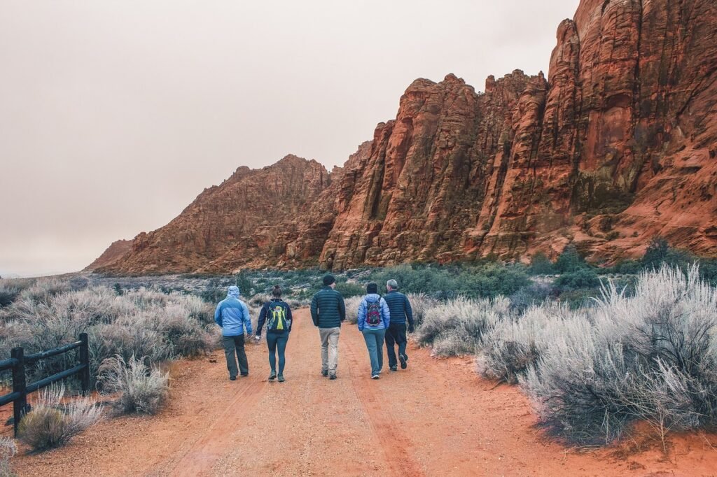
Sedona is renowned for its breathtaking red sandstone formations that create a one-of-a-kind backdrop for hiking. Located south of Flagstaff, Sedona’s red rock country is carved by Oak Creek and dotted with trails ranging from easy walks to strenuous climbs up steep slickrock.
One of Sedona’s most iconic hikes is the Cathedral Rock Trail. This moderately difficult trail winds through the red rocks, leading to the famous Cathedral Rock formation with stunning views. The trail gains over 1,000 feet in elevation over 1.5 miles as it passes through anarrow red rock canyon before emerging onto the open slickrock. Scrambling up to the saddle of Cathedral Rock reveals panoramic vistas of the surrounding sandstone monoliths and canyons.
For a more challenging hike, and my favorite, Devil’s Bridge Trail offers adventurous hikers the chance to stand on top of a natural sandstone arch. The trail leads uphill through sandstone passages before reaching the narrow span of Devil’s Bridge arch. Scrambling up to the top allows hikers to take in the exhilarating view through the arch to the canyon below. This strenuous 4.2 mile hike requires sure footing and steep sections of climbing.
Sedona’s scenic hikes through the red rocks offer awe-inspiring views and an unforgettable adventure. Whether it’s an easy walk or a steep climb, Sedona’s trails showcase the area’s iconic sandstone formations in all their glory.
Phoenix
Phoenix is home to some of the most popular urban hiking trails in Arizona. These trails weave through the mountains scattered throughout the metro area, offering convenient day hikes with beautiful views right in the middle of the city.
The most popular hike in Phoenix is Camelback Mountain. Located in the heart of Scottsdale, Camelback offers a challenging climb up a steep and rugged trail to the summit of one of the region’s iconic peaks. The views from the top overlook Phoenix and the Valley of the Sun for a stunning 360 degree panorama. The hike is 2.2 miles roundtrip and gains approximately 1,200 feet in elevation.
Neighboring Camelback Mountain is Piestewa Peak, another prominent Phoenix landmark. Previously known as Squaw Peak, it was renamed in 2003 in honor of Lori Piestewa, the first Native American woman to die in combat while serving in the U.S. military. The Summit Trail is 2.1 miles roundtrip and gains about 1,150 feet in elevation. Hikers are rewarded with sweeping views of Phoenix and beyond.
South Mountain Park is one of the largest city parks in the nation at over 16,000 acres. It’s home to a network of trails through rugged desert scenery with petroglyphs and native desert vegetation. Some of the most popular hikes include the National Trail and the Mormon Trail, which range from 3 to 8 miles round trip with great views of downtown Phoenix and the surrounding mountains.
With towering peaks scattered across the Valley, Phoenix offers great diversity for hikers right within the city limits. These iconic urban trails showcase the beautiful fusion of desert and metropolis that makes Phoenix such a dynamic hiking destination.
Tucson
The desert setting of Tucson in southern Arizona provides beautiful scenery and challenging hiking terrain. Sabino Canyon, Ventana Canyon, and Tanque Verde Falls are some of the top places for hiking near the city.
Sabino Canyon, located in the Coronado National Forest north of Tucson, offers several excellent hiking trails through the canyon filled with streams, waterfalls, and riparian vegetation. The most popular hike is the Sabino Canyon Trail that goes 7.5 miles one-way and gently climbs to lower Bear Canyon. For something more strenuous, hikers can take the Bear Canyon Trail that branches off and travels 4 miles up to Seven Falls.
Ventana Canyon on the eastern outskirts of Tucson provides spectacular views of the Santa Catalina Mountains. The Ventana Canyon Trail starts from the visitor center and climbs steeply up the canyon for 3.4 miles one-way where hikers are rewarded with the window-like views that give the canyon its name. The trail passes by Maiden Pools, a popular spot for swimming in the naturally formed rock pools.
The hike to Tanque Verde Falls starts in Saguaro National Park East and descends 600 feet over 3 miles to reach the scenic waterfall. The trail passes through diverse desert landscapes before arriving at the falls that cascade down tan rock cliffs into a pool surrounded by cottonwood trees. The hike involves some boulder hopping and wading through water, providing a fun adventure in the Sonoran Desert.
With epic mountain views, lush canyons, and cascading waterfalls, Tucson offers some of the best desert hiking trails in Arizona. The challenging terrain provides endless opportunities for outdoor enthusiasts to explore the natural beauty surrounding the city.
Flagstaff
Flagstaff is a popular destination for hikers, offering a variety of trails with stunning views, diverse terrain, and peaks over 12,000 feet. The most notable hike is Humphreys Peak, the highest point in Arizona at 12,633 feet. Located in the Kachina Peaks Wilderness Area, Humphreys Peak Trail is considered difficult, with an elevation gain of over 3,000 feet. However, reaching the summit provides magnificent 360-degree views of the San Francisco Peaks and surrounding areas.
For a slightly easier hike with similar rewards, many opt for the Kachina Trail. This scenic 6-mile loop also leads to the summit of the San Francisco Peaks, delivering outstanding vistas of mountains, forests, and valleys. Much of the trail follows the Weatherford Trail before splitting off to create the loop. Hikers pass through mixed conifer forests with quaking aspens and climb over 1,000 feet in elevation. The high altitude combined with steep sections make it a moderate-strenuous route.
Whether looking to bag a high peak or soak in panoramic views, Flagstaff offers premier hiking opportunities to experience the diverse beauty of northern Arizona. The cooler temperatures at 7,000 feet make it an ideal escape during the hot summer months. From alpine summits to lush forests, Flagstaff trails reward hikers with a wide range of landscapes and memorable adventures.
White Mountains
The White Mountains in east-central Arizona offer some of the state’s most spectacular wilderness hiking. This rugged region is home to the highest peak in Arizona, Mount Baldy, which reaches 11,400 feet above sea level. The centerpiece is the Mount Baldy Wilderness, surrounded by the Apache-Sitgreaves National Forest.
Mount Baldy provides a challenging hike with incredible views from the summit. The trail gains over 4,000 feet in elevation as it climbs through spruce-fir forests and above the treeline to the rocky peak. Hikers are rewarded with 360-degree panoramas encompassing other peaks of the White Mountains and sweeping desert views.
Another exceptional hiking trail in the White Mountains is Escudilla Mountain. The trailhead begins in an aspen grove, winding up a steep trail to the Escudilla summit at 10,912 feet. From there, hikers take in vistas of the painted desert and landmarks like Mount Humphreys. Wildflowers also burst into bloom here in summer, coating the mountainsides with color.
With its high-mountain wilderness feel, the hiking trails in the White Mountains offer an escape into remoteness and natural beauty. The area contrasts with the low-elevation desert hikes found elsewhere in Arizona. For hikers seeking spectacular alpine scenery and demanding trails leading to lofty heights, the trails of the White Mountains deliver.
Petrified Forest National Park
Petrified Forest National Park in northeastern Arizona is famous for its fossils of petrified wood, while at the same time also offering some great hiking trails that showcase the beautiful colors and textures of the Painted Desert landscape.
Three notable hiking trails at Petrified Forest National Park are the Blue Mesa Trail, Crystal Forest Trail, and Giant Logs Trail:
Blue Mesa Trail

The Blue Mesa Trail is a 1 mile loop trail that leads hikers through badland hills of bluish bentonite clay. This clay erodes into small knobs and spires that resemble a martian-like landscape. The contrast of the blue bentonite clay with the red and orange layers of rock make for amazing photo opportunities. While a short trail, the constantly changing terrain makes it moderately strenuous. This trail is especially interesting when the bentonite clay is wet and takes on a brighter blue hue.
Crystal Forest Trail
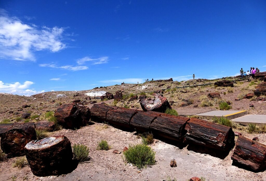
As the name implies, the 0.8 mile Crystal Forest Trail brings hikers through an area dense with petrified wood that looks like giant quartz crystals. Most of the petrified logs in this area are fractured into beautiful amethyst-like pieces. Here you can see first-hand how logs were buried in layers of mud and ash, crystallized into quartz formations, then fractured over the years by natural processes. This short loop trail has information signs explaining the science behind the petrified wood.
Giant Logs Trail
This 0.4 mile trail highlights some of the park’s largest petrified logs, some over 9 feet in diameter. A short walk leads to Old Faithful Log, the park’s longest petrified log spanning over 170 feet. The trail loops through the park’s northern area where the density of petrified wood scattered on the desert floor will amaze you. While short, the Giant Logs Trail gives a quick glimpse into the impressive size of ancient fallen trees.
Petrified Forest National Park preserves an important record of Triassic Era fossils. Beyond appreciating the petrified wood, the park also offers scenic hiking trails with panoramic views of the Painted Desert’s mesas, cliffs and erosional forms. With short trail distances, this park is suitable for most hiking abilities.
Saguaro National Park
Located just outside Tucson, Saguaro National Park showcases some of Arizona’s most iconic landscapes. The park is divided into two sections, with the western portion featuring the breathtaking Saguaro cacti that the park is known for. One of the most popular hikes in this section is the Cactus Forest Loop trail. Winding through dense stands of towering saguaro cacti, it’s easy to see where this trail gets its name. The scenic path is just over 5 miles long and crosses sandy washes lined with colorful wildflowers after the scant rains. As you hike, keep an eye out for wildlife like coyotes, jackrabbits, and a variety of desert birds.

For panoramic views, head to the Signal Hill picnic area and short interpretive trail. At the trailhead, you’ll find informative signs about the saguaro and other desert plants. The short uphill path leads to a rocky overlook with sprawling views of majestic saguaros dotting the hillsides set against the backdrop of the city of Tucson. Sunset from the Signal Hill Overlook is an excellent way to end a day of exploring this iconic Arizona landscape. Beyond getting up close with the saguaro cacti, a hike through Saguaro National Park allows you to experience the true beauty of the Sonoran Desert.
Conclusion
Arizona is home to some of the most spectacular and diverse hiking trails in the United States. From the awe-inspiring depths of the Grand Canyon to the soaring red rocks of Sedona, Arizona’s trails showcase the state’s incredible range of landscapes and ecosystems.
You should be prepared for the unique challenges posed by the climate and terrain. Summers can be extremely hot, especially in low elevation areas like Phoenix and Tucson. Hiking in the heat requires extra precautions like getting an early start, carrying plenty of water, protecting yourself from the sun, and being alert for signs of heat exhaustion. Winter in the high country brings the possibility of snow and ice, so traction devices or poles can be helpful for stability.
No matter which trails you explore, come prepared with sturdy footwear, plenty of water and snacks, sun protection, and appropriate layers. Pay close attention to posted signs and warnings to avoid getting lost. Consider hiring an experienced guide for technical routes or challenging areas like the Grand Canyon.
With reasonable preparation and precautions, Arizona’s trails offer remarkable opportunities to experience the beauty and diversity of the Southwest on foot. From desert hikes among saguaro cacti to alpine forests and windswept canyons, Arizona has something for hikers of every ability level. Visitors walk away with a deepened appreciation for the incredible landscapes of America’s sixth largest state.
Plan your trip with ease by visiting our Accommodation and Transportation pages. Discover unbeatable deals for a seamless and unforgettable adventure!
